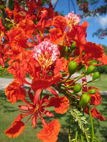
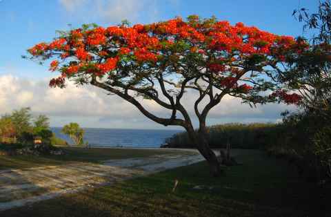
Flame tree flower and tree.
WWII and Today
|
Also see these Chuuk (Truk) pictures |
Maps/Geography - where are the Northern Mariana Islands?
Find the area on the globe, then take a closer look.
A good collection of maps is also hosted by the 40th Bombardment Group.
The Marianas is an arc of 14 islands extending 420 miles (700 km) north of Guam. The Mariana Trench parallels the chain about 35 miles to the east. At 11,033 meters it is the deepest trench on earth (deeper than Mt. Everest is tall). The southern islands are composed of volcanic rock and coral limestone. The elevation of the coral has created unique terraced formations including large plains and steep cliffs. The northern islands are mostly volcanic and one of them (Anatahan) is still active.
History
The native Chamorros settled the islands about 4000 years ago. People from the Caroline Islands (now the Federated States of Micronesia) south of the Marianas didn’t start to settle the islands until about 1000 years ago. Originally called Islas de los Ladrones by Magellan, King Charles II of Spain officially named them the Mariana Islands in 1669 after his mother, Queen Maria Ana of Austria. The Spanish claimed the islands and resettled the natives to Guam, which was colonized for over 300 years. After the Spanish-American War, the Spanish sold the islands to Germany in 1899.
Uncontested, the Japanese took control of the islands in 1914 from Germany during WWI. The Japanese brought Japanese, Okinawan, and Korean immigrants to work in the sugar cane industry started by Haruji Matsue. After several decades of commercial growth, the islands were increasingly militarized and construction was undertaken on military fortifications. These included the Last Command Post on the north end of Saipan where General Yoshitsugo Saito commanded the last Japanese troops defending the island. Tens of thousands of people died during the fighting, including many civilians.
In 1947 all the Japanese-held Micronesia Islands were put in U.S. control as part of the U.S. Trust Territory of the Pacific and, after a plebiscite, the Northern Marianas became a U.S. Commonwealth in 1975. Today Saipan is the center for a large garment industry that takes advantage of Saipan’s status as a commonwealth of the U.S. and is not subject to most labor laws. The tradeoff for the tax revenue that this industry generates are a strain on the island’s infrastructure and social costs for the temporary workers, including sweatshop working conditions and minimal pay.
Plants
The U.S. military planted the aggressive tamarind Leucaena tree after WWII to reduce erosion of the battle-scarred landscape. Now it is considered an invasive species and presents many of the same problems that it does in places like St. John in the Caribbean. Another intruduced species, the Flame tree (Caesalpinia), was brought from the West Indies but instead it's celebrated with the annual Flame Tree Festival. Another tropical tree, the betelnut, can also be found in the Marianas. Chewing of the betelnut is so common among locals the you’ll see “No Betelnut Spitting!” signs posted. The nut is a stimulant that gives it’s user's teeth and gums a telltale red stain. Over time, users suffer tooth loss and a higher incidence of cancer than normal.
Flame tree flower and tree.
SPN – Saipan International Airport
ROP – Rota International Airport
TIQ – Tinian West Field Airport
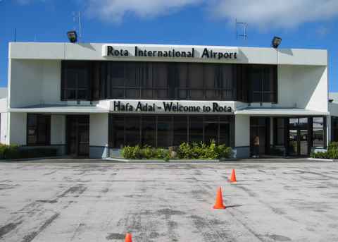
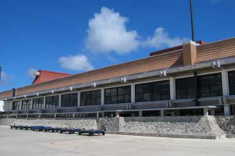
Rota's airport terminal. Saipan International Airport.
War Comes to the Marianas
A collection of pictures by the MICRONESIAN SEMINAR (MicSem), a private non-profit, non-governmental organization Established as a research-pastoral institute by the Catholic Church, and turned over to the Jesuit Order in 1992.
The Marianas Project
A good survey of WWII history on the Marianas.
Manhattan Project Heritage Preservation Association, Inc. (MPHPA)
Good resource and historical pictures.
All rights reserved in all media. Permission is granted to individuals, researchers and educators to make copies of the Website's contents for educational purposes that generate no revenue. No other publication, copying, electronic transmission, use, or reproduction is permitted without advance written permission. Every commercial or revenue-producing use or electronic reproduction (reproduction in any form that does not produce a hard copy print out) of Website material whether or not for educational or research purposes, requires advance written permission.
© Copyright 2006