Marianas Homepage
Maps North Tinian | South Tinian | West Tinian | North Field | Ushi Field 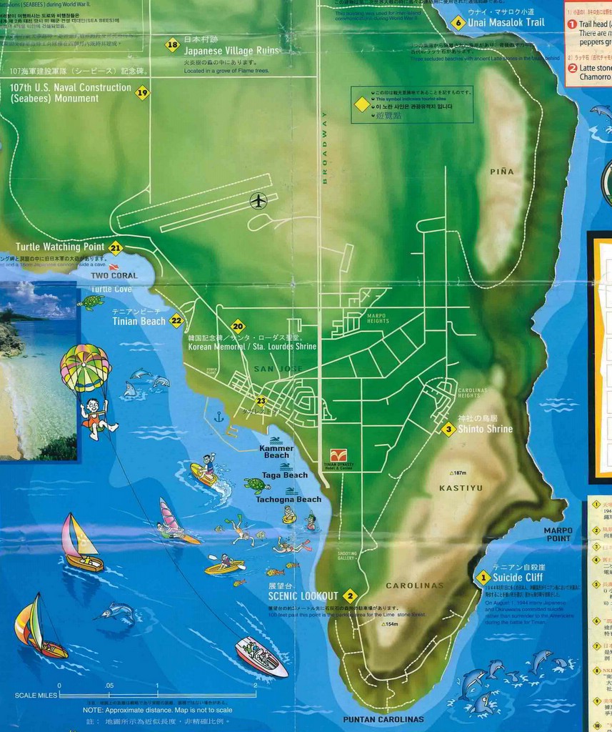 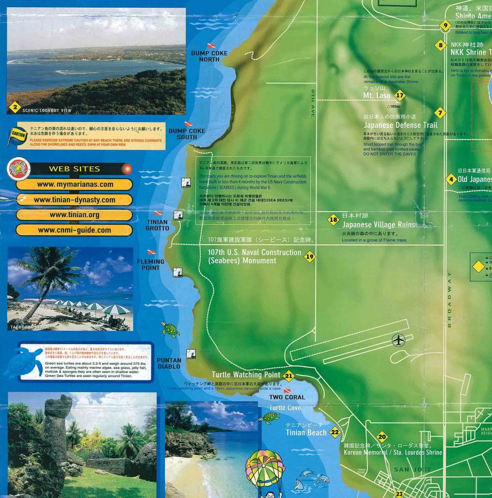  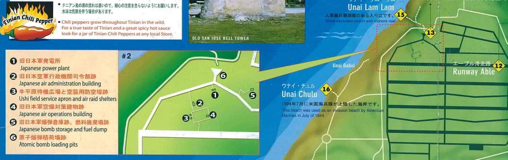
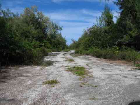
North Field
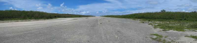
Tinian played and important role in the final stage of the war of the Pacific. The Seabees and Marines constructed six air strips on the island, four of them being on North Field. Each had an alphabetical designation [A (Able), B (Baker), C (Charlie) and D (Dog)] with Able being the northernmost and the one used by the Enola Gay and Bockscar on their missions to drop their atom payloads on Hiroshima and Nagasaki, Japan. Before the the U.S. took control of the island, the Japanese had and airfield in Northern Tinian named Ushi Field. After the invasion, construction of the U.S. air strips began around October 1944 and the first bombers landed on January 18, 1945. The roadways and air strips were constructed of crushed coral and asphalt. As you travel east along the runways, there is a noticeable increase in elevation from about 50 to 100 feet. By February, B-29 Superfortress bombers were already taking-off for the ten-hour flight to targets on the Japan mainland. A period picture of North Field shows it as it looked after July 1944 but before May 1945 when construction of Runway Four was completed.
Two B-29 airstrips and a third one for smaller aircraft were built by the Seabees further south, near the Japanese Kahit Airfield. These were named West Field and the smaller runway is still in use as a civilian airport.
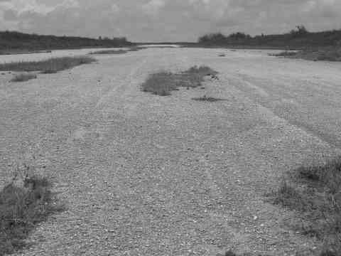
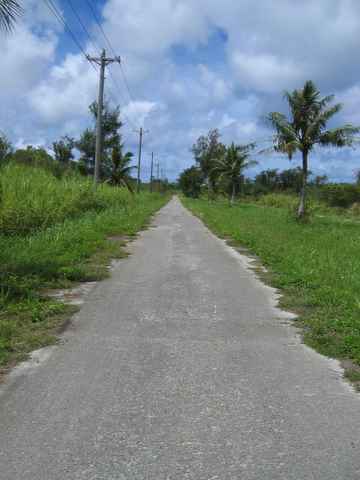
Runway B (Baker)
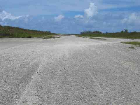
Runway C (Charlie)
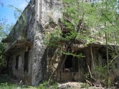
Air Operations Building 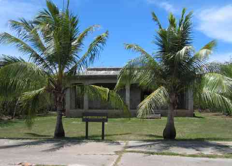 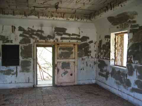 This building was the control center for the Ushi Airfield complex and air operations on Tinian. It consisted of an office, operations room, and a generator room. The design is similar to other Japanese air operations buildings including the one at Saipan's As Lito Field. After the U.S. captured Tinian, it was used as the North Field control tower by the 20th Air Force as shown in this photograph taken on August 11, 1945. Air Raid Shelters 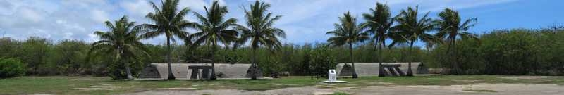 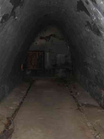 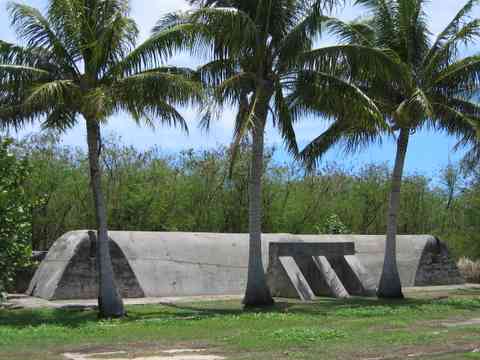 These structures are across the large concrete clearing from the Air Operations Building. Air Administration Building 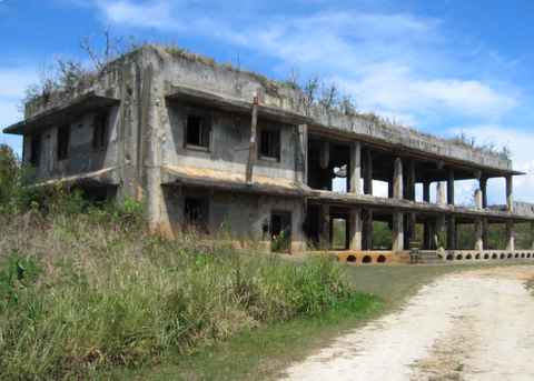 The Air Administration Staff Building was the headquarters for the Japanese Navy's 1st Air Fleet and commanded by Vice Admiral Kakuji Kakuta. This was part of Japan's Central Pacific Area Fleet and included air fields in the Marianas and Iwo Jima. Early in the war these fields served as staging areas for transporting aircraft to Southern Pacific battle areas and attacks on ships. By the time of the Battle of the Philippine Sea (Battle of the Marianas) in June of 1944, the Japanese had lost most of their experienced pilots. In this decisive battle the remaining aircraft under Kakuta's command were destroyed.
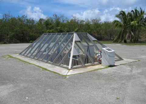
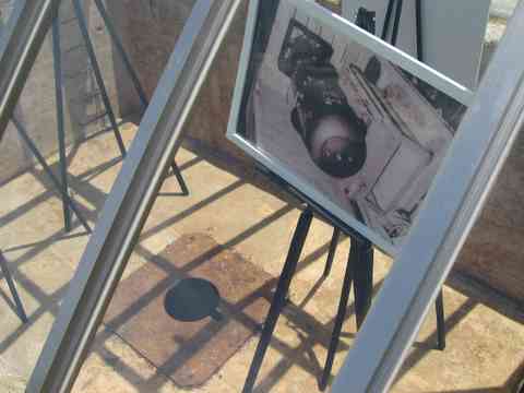
The B-29 Enola Gay was towed over atomic bomb pit no. 1 and the uranium bomb named "Little Boy" was loaded in the evening of August 5, 1945. At 8:16 am the next day, the 9,000 pound bomb was detonated 1,890 feet above Hiroshima. The immediate effects were the estimated death of 70,000 people, which grew to 100,000 by year's end and later to over 200,000 after succumbing to the long-term effects of radiation. The Enola Gay is displayed at the Steven F. Udvar-Hazy Center annex of the National Air and Space Museum, located near Dulles Airport, Virginia. Enola Gay being backed-up and positioned over the bomb pit. The Manhattan Project: An Interactive History - The atomic bombing of Hiroshima.
Atomic Bomb Pit 2 (east) 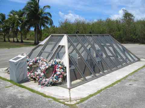 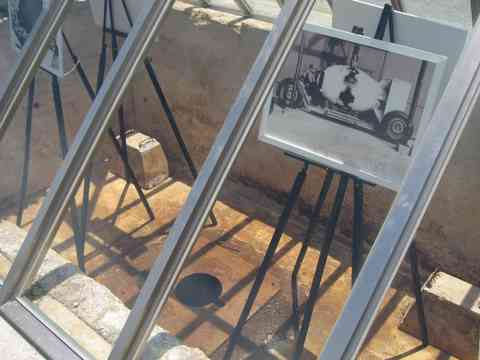 On August 8, 1945, the B-29 named "Bockcar" (possibly Bock's Car) was towed over atomic bomb pit No. 2 and loaded with the plutonium bomb "Fat Man." The 10,000 pound bomb was dropped above Nagasaki at 11:02 am on August 9, 1945. The resulting blast and radiation killed an estimated 40,000 people, which grew to 70,000 by year's end and later to over 140,000 after the long-term effects of radiation. Cloud cover obscured the primary target (Kokura) so the secondary target of Nagasaki was chosen. Bockscar is on display at the National Museum of the United States Air Force on the grounds of the Wright-Patterson AFB near Dayton, Ohio. The nose art was added after the crew returned from the mission. Fat Man – color Fat Man – B&W The Manhattan Project: An Interactive History - The atomic bombing of Nagasaki
Power House
Diesel Oil Storage Building
The power plant supplied 200 kW of electricity to Ushi Field and it's complex of buildings. The oil storage building housed two large diesel tank that supplied fuel to the generators in the power house and the nearby water storage tank kept the generators cool.
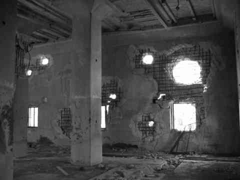
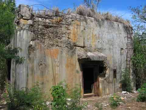
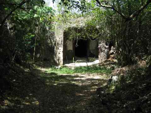
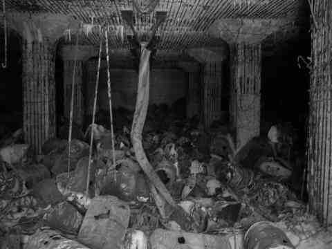
Fuel Storage Bunker #1 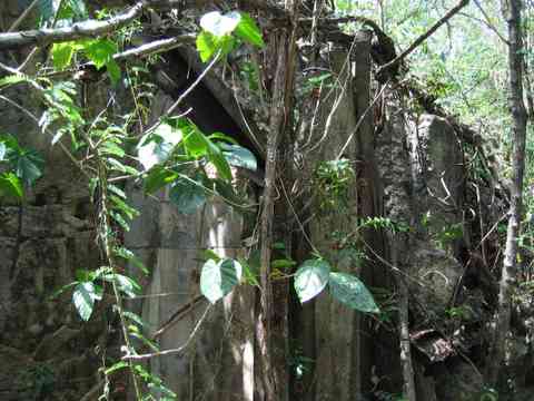 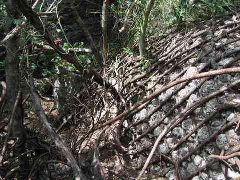 The fuel drums were ignited within the first days of the U.S. invasion, leaving burnt and exploded drums. Pictures were also taken by Construction Battalion Maintenance Unit #593 (CBMU593) early during the airbase construction from 1944-1945 showing the bunker's entrance. Munitions Storage Bunker #2
Unlike the fuel bunker, the munitions bunker exploded, leaving very little of the structure intact. A historical picture of the Japanese Storage Bunker #1 was taken after the invasion.
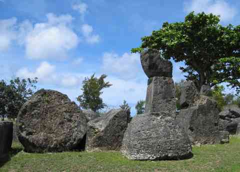
Around the Island
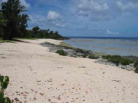
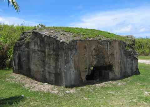
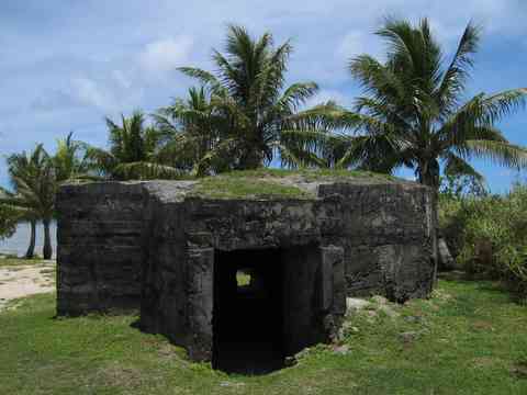
Invasion Beach "White 2" (Chulu)
On July 24, 1944 the 2nd and 3rd Assault Battalions, of the 25 Marine Regimement, 4th Marine Division landed on Babui and Chulu Beach with 16 LVT (Am Tracs). The U.S. Marines designated these assault beaches "White 1" and "White 2" respectively. Babui beach is located just north of Chulu. The landing sites were a surprise to the Japanese since their combined length is only 220 yards (201 meters). By the end of the first day 15,000 Marines had made landfall and secured a 1 mile radius beachhead. The whole of Tinian was secured on August 1, 1944. The invasion of Tinian has been viewed as perhaps the most successful amphibious invasion of the war. Tinian Beaches Invasion Beach Bunker
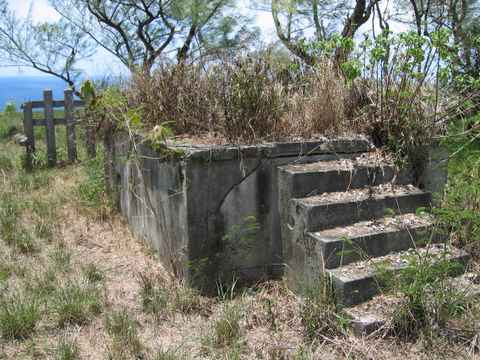
This is one of the two bunkers that are on each end of the beach. This blockhouse contained a 37mm M94 AT gun.
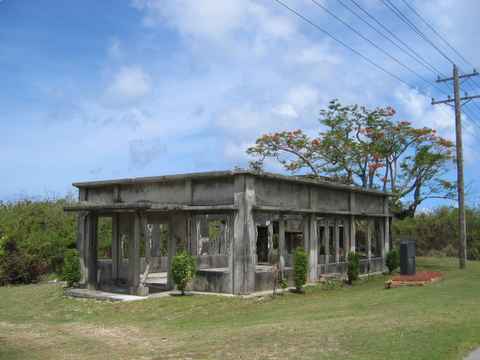
The Radio Communication Building was used for inter-island radio communication by the Japanese. More recently, it was used by a ranch on Tinian as a slaughterhouse but is now completely abandoned.
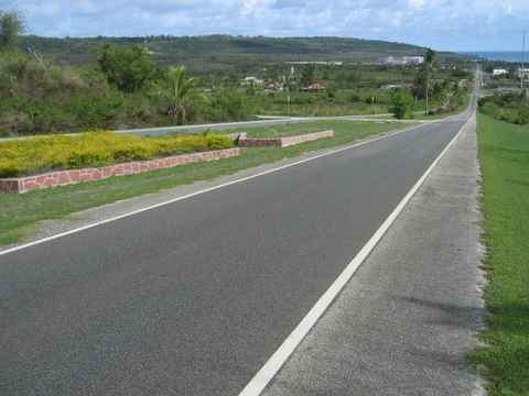
Broadway south of the airport near San Jose. Broadway some distance north of the airport.
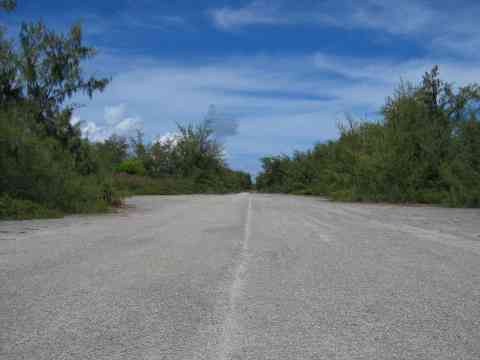
 A view of 8th Avenue leading north from West Field.
External Resources "Tanks Ashore, Tinian" - tanks landing on the invasion beach. Official U.S. Marine Corps Photograph, Graflex. Donated by Joseph Garofalo, 121st Seabees, 4th Marine Division 1944. Tinian Brochure A Self-Guided Tour of Historic North Tinian
Tinian National Historical Park Study An extensive reported, dated September 2001, by the United States Department of the Interior - National Park Service to determine the appropriateness of including Tinian’s WWII historic areas in the National Park System.
A website by Typhoon Larry, Larry Brewster, who has lived in the Islands for 20 years.
Very good pictures from The 6th Bomb Group.
Pictures of Tinian in July 1988
Ray Martin's collection of WWII Tinian photographs.
San Jose
Pictures by Construction Battalion Maintenance Unit #593 (CBMU593) taken early during the airbase construction from 1944 – 1945 were much as they are now.
Haruji Matsue and Nanyo Kohatsu Kaisha (Nanko) established the sugar industry in the Micronesian Islands. It began on Saipan on November 1921. Later, sugar manufacturing expanded to Tinian (nicknamed sugar island), begining with a 1928 land reclamation project and continuing in 1930 and 1935 with the completion of sugar processing factories, each with a daily capacity of 1,200 tons of raw material. Okinawans accounted for over 55,000 of the laborers and more than half of the workers in the industry. Saipan served as the headquarters for the Saipan, Tinian, and Rota operations and today you can visit Sugar King Park in Garapan that commemorates the contributions of Matsue and the sugarcane industry to the Northern Marianas. The National Park Service Tinian WWII photo album.
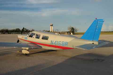
A good collection of pictures hosted by the 40th Bombardment Group. Freedom Air operates daily commuter flights from Saipan International Airport to Tinian International Airport from 06:45 to 18:00. You will likely take a low-altitude (1600 ft. asl) aboard a Piper PA-32 Cherokee Six or Shorts 360 for the 15-minute flight to Tinian. The total cost each way is $32. When you arrive in Tinian you can arrange for a rental car with Tropical Car Rental at the airport or with Avis, which has an office at the garish and ultra-expensive Dynasty Hotel & Casino several miles south of the airport. Rental rates are generally $35 a day in the Northern Marianas.
An alternative way to reach Tinian is by ferry from the Saipan commercial dock. An affiliate company of Tinian Dynasty Hotel & Casino operates a ferry service and provides two 60-minute daily trips each way. The company's boat, Tinian Express, ran aground in the early morning of October 10, 2005 but it's second boat, the Saipan Express, still operates and leaves from Saipan at 9:30am, and 5pm and from Tinian at 8am and 1pm. Tickets are $17.25 each way. Because of the reduced schedule, it's not possible to visit Tinian on a day trip unless you go by air. Go to top of page
All rights reserved in all media. Permission is granted to individuals, researchers and educators to make copies of the Website's contents for educational purposes that generate no revenue. No other publication, copying, electronic transmission, use, or reproduction is permitted without advance written permission. Every commercial or revenue-producing use or electronic reproduction (reproduction in any form that does not produce a hard copy print out) of Website material whether or not for educational or research purposes, requires advance written permission. |